Chindia Alert: You’ll be Living in their World Very Soon
aims to alert you to the threats and opportunities that China and India present. China and India require serious attention; case of ‘hidden dragon and crouching tiger’.
Without this attention, governments, businesses and, indeed, individuals may find themselves at a great disadvantage sooner rather than later.
The POSTs (front webpages) are mainly 'cuttings' from reliable sources, updated continuously.
The PAGEs (see Tabs, above) attempt to make the information more meaningful by putting some structure to the information we have researched and assembled since 2006.
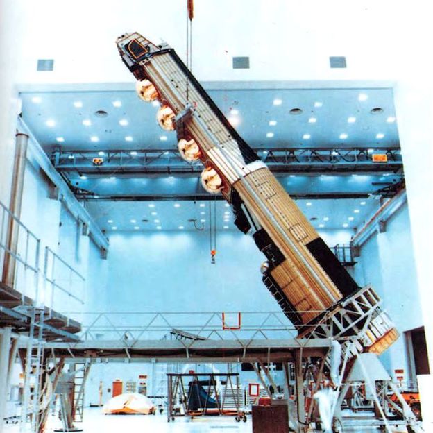
Joint mission will send two unmanned probes into orbit around the closest planet to the sun
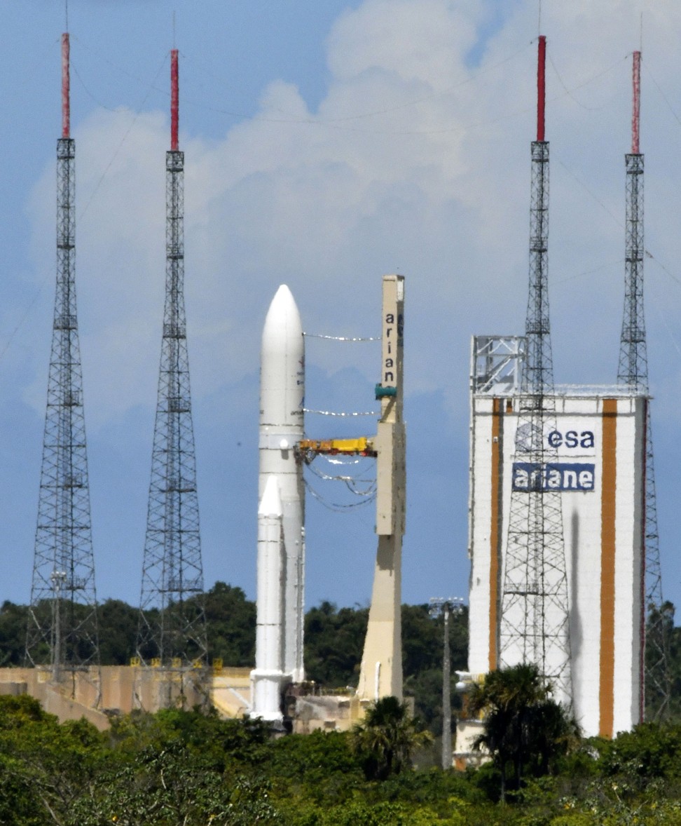
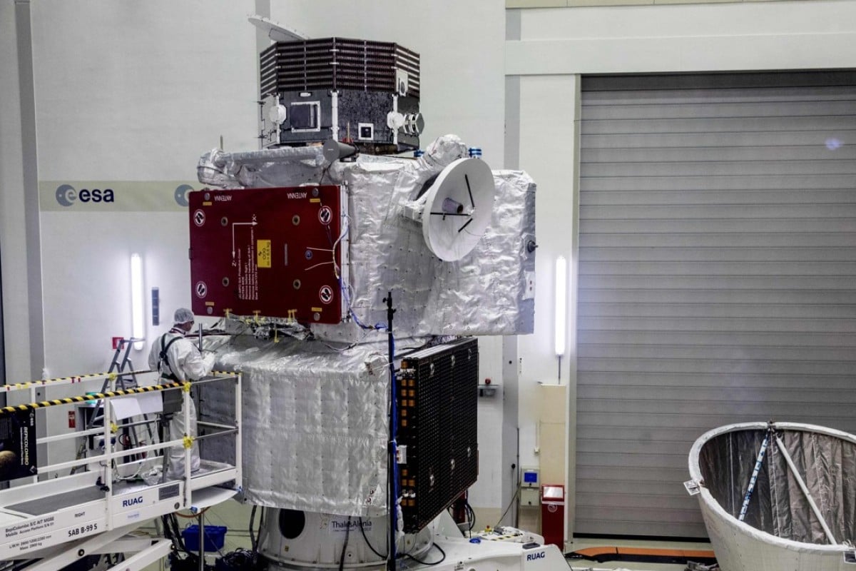
The BepiColombo standing in position at a test facility in Spijkenisse. Its mission to Mercury is scheduled for launch on an Ariane 5 from Europe’s Spaceport in Kourou, French Guiana on October 20. Photo: AFP Photo
Final preparations were underway on Friday for the launch of a joint mission by European and Japanese space agencies to send twin probes to Mercury, the closest planet to the sun.
An Ariane 5 rocket is scheduled to lift the unmanned spacecraft into orbit from French Guiana shortly before midnight, the start of a seven-year journey to the solar system’s innermost planet.
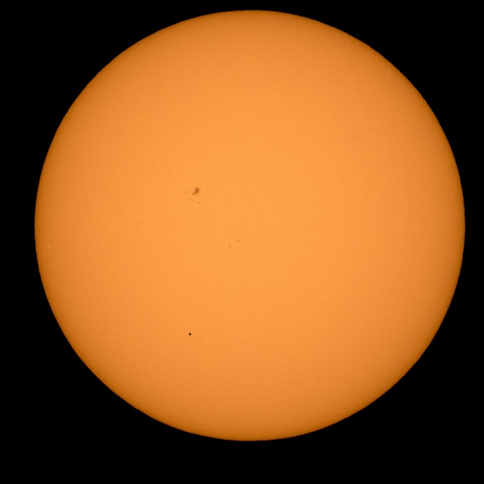
Mercury is seen in silhouette, lower third of image, as it transits across the face of the sun. Photo: AFP PHOTO / NASA / BILL INGALLS
The European Space Agency says the €1.3 billion (US$1.5 billion) mission is one of the most challenging in its history. Mercury’s extreme temperatures, the intense gravity pull of the sun and blistering solar radiation make for hellish conditions.
The BepiColombo spacecraft will have to follow an elliptical path that involves a fly-by of Earth, two of Venus and six of Mercury itself so it can slow down sufficiently before arriving at its destination in December 2025.
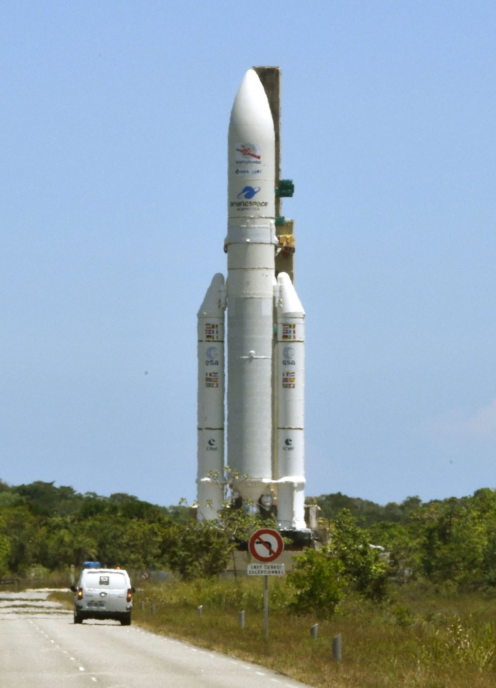
An Ariane-5 rocket is set for launch at the Guiana Space Centre in Kourou in French Guiana. Photo: Kyodo
Newly developed electrical ion thrusters will help nudge the spacecraft, which was named after Italian scientist Giuseppe “Bepi” Colombo, into the right orbit.
Aborted launch astronauts may head to International Space Station this year: Nasa head says
12 Oct 2018
When it arrives, BepiColombo will release two probes – Bepi and Mio – that will independently investigate the surface and magnetic field of Mercury. The probes are designed to cope with temperatures varying from 430 degrees Celsius (806F) on the side facing the sun, and -180 degrees Celsius (-292F) in Mercury’s shadow.
An Ariane-5 rocket is transported to its launch site at the Guiana Space Centre in Kourou. Photo: Kyodo
Scientists hope to build on the insights gained by Nasa’s Messenger probe, which ended its mission in 2015 after a four-year orbit of Mercury. The only other spacecraft to visit Mercury was Nasa’s Mariner 10 that flew past the planet in the mid-1970s.
Japanese space robots have landed on asteroid to carry out world-first survey
22 Sep 2018
Mercury, which is only slightly larger than Earth’s moon, has a massive iron core about which little is known. Researchers are also hoping to learn more about the formation of the solar system from the data gathered by the BepiColombo mission.
Modified version of country’s most powerful rocket carries next-generation capsule designed to take astronauts to its planned space station
It will be able to launch and land with three crew members and up to 500kg of cargo, according to state media
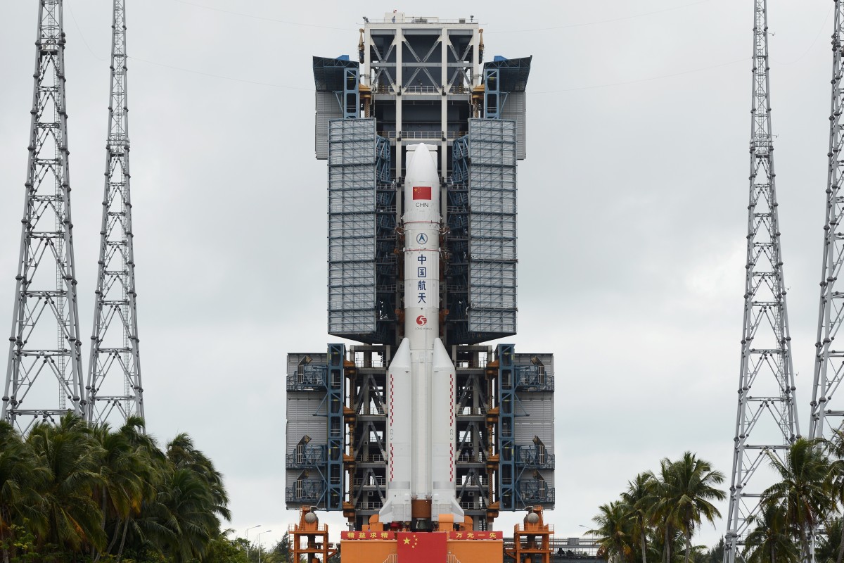
China launched a new version of its heavy-lift Long March 5 rocket on Tuesday. Photo: Reuters
China successfully launched a prototype of its next-generation manned spacecraft – without astronauts – along with a new version of its heavy-lift Long March 5 rocket on Tuesday, its space agency said.
The Long March 5B rocket was launched into low-Earth orbit from the Wenchang Satellite Launch Centre on Hainan Island in the country’s south.
The launch marks a significant step forward for China’s two big space exploration ambitions – building a space station and a mission to Mars.
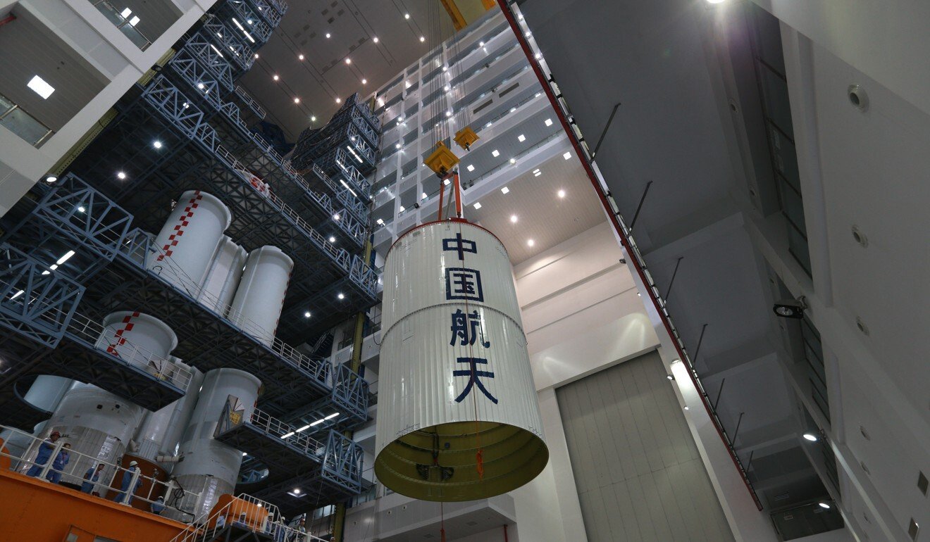
A modified version of China’s most powerful rocket, the Long March 5B is 53.7 metres (176 feet) tall. It will carry the next-generation crew capsule prototype designed to replace the Shenzhou spacecraft, to transport astronauts to its planned space station in low-Earth orbit.
China aims to launch the core module of that space station designed for three crew members, the Tianhe, in 2021. Beijing has been planning to build its own space station for decades as an alternative to the International Space Station, from which China has been excluded by the United States over security concerns.
China’s space station project has been delayed by problems with its heavy-lift rockets. Photo: Xinhua
The prototype capsule has a different configuration to Shenzhou’s and it will be able to launch and land with three astronauts on board as well as up to 500kg of cargo, according to state news agency Xinhua. That will mean it can be used to transport research specimens and hardware from the space station back to Earth.
While the Shenzhou can ferry three astronauts, the new capsule design will be able to accommodate up to six crew members and, unlike the Shenzhou, it will be capable of carrying them to the moon, according to Chinese media reports.
Its systems, performance in orbit and parachute deployment are among the areas that will be put to the test during the launch.
Why China’s next Long March 5 rocket mission will be about restoring national pride
14 Dec 2019
The long-anticipated space station project has been delayed by problems in the development of heavy-lift rockets to carry the modules. In 2017, an oxygen supply problem caused the failure of the second Long March 5 launch, and it plunged into the Pacific Ocean shortly after take-off. But in December it successfully carried a Shijian-20 satellite into orbit, while the liquid oxygen-liquid hydrogen engines used in both the Long March 5 and 5B rockets passed testing in January.
China’s other space ambitions include a Mars probe, and landing astronauts on the moon within the next decade. For the Mars mission, the unmanned orbiter and rover Tianwen-1 will be launched by the Long March 5 and it is expected to take up to seven months for the probe to reach the red planet. China would be the third country to do so – after the United States and the Soviet Union.
Zhang Kejian, head of the China National Space Administration, said China was on track to launch the mission this year, with July the likely launch date.
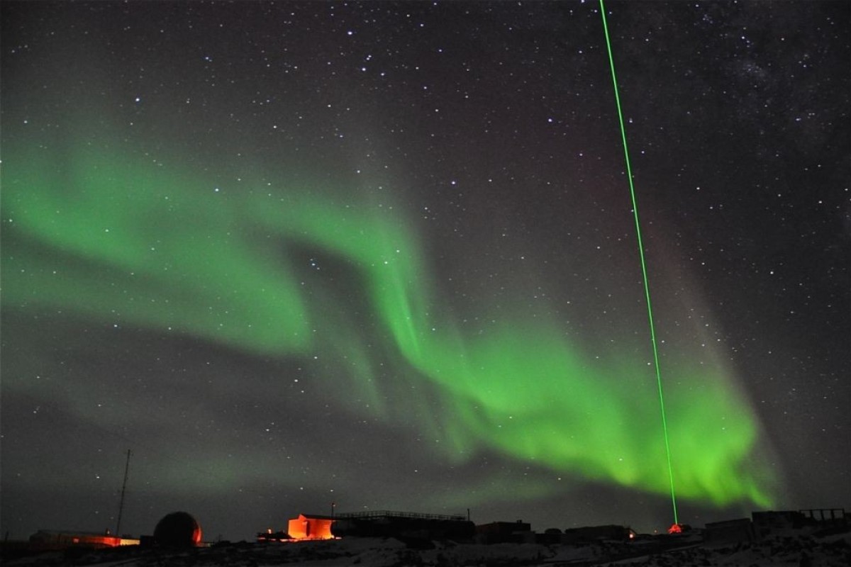
New facility is designed to help scientists study particles that help deflect cosmic rays in the high atmosphere
Despite scepticism among some scientists, those familiar with the project insist radar will have a range about 10 times greater than existing ones
When completed the new laser radar will be used to study the high atmosphere. Photo: Handout
China has started building the world’s most powerful laser radar designed to study the physics of the Earth’s high atmosphere, according to state media reports and scientists informed of the project.
It is described as having a detection range of 1,000km (600 miles) – 10 times that of existing lasers – and will be used to study atmospheric particles that form the planet’s first line of defence against hostile elements from outer space such as cosmic rays and solar winds.
The facility, to be built on a site that remains classified, is expected to be up and running within four years and will form part of an ambitious project to reduce the risk from abnormal solar activities.
The radar will use a high-energy laser beam that can pierce through clouds, bypass the International Space Station and reach the outskirts of the atmosphere, beyond the orbiting height of most Earth observation satellites.
Lasers help tell ghostly story of doomed Nazi submarine U-576 and its entombed crew
There, the air becomes so thin that scientists will be able to count the number of gas atoms found within a radius of several metres.
These high-altitude observations could greatly expand our knowledge of a part of the atmosphere that has been little studied because the distances involved mean no one has been able to make direct observations from the ground.
“The large-calibre laser radar array will achieve the first detection of atmospheric density of up to 1,000km in human history,” said a statement posted on the website of the Chinese Academy of Sciences on Tuesday, a day after the launch of the project.
But the claim has been greeted with some scepticism in the scientific world.
“I think the 1,000km is a misprint!” professor Geraint Vaughan, director of observations at the National Centre for Atmospheric Science in the UK, replied when asked about the project.
Vaughan, who is also a Fellow of the Royal Meteorological Society, said that while he thought the Chinese announcement was “very interesting”, it did not seem possible with existing technology.
At present, the effective range of atmospheric lasers is about 100 kilometres.
Some other senior scientists in China and overseas also expressed doubt about the project, although they requested anonymity due to the sensitivity of the issue.
US warns airmen to beware of laser attacks near China’s military base in Djibouti
“There are other approaches, such as launching a satellite. Building such a huge, expensive machine on the ground does not make sense,” said a Beijing-based laser scientist.
But several researchers told the South China Morning Post that the project did exist, and insisted that 1,000km range was not a mistake.
Hua Dengxin, a professor at Xian University of Technology and a lead scientist in China’s laser radar development programmes, said: “I have heard of the project, yes. But I cannot speak about it.”
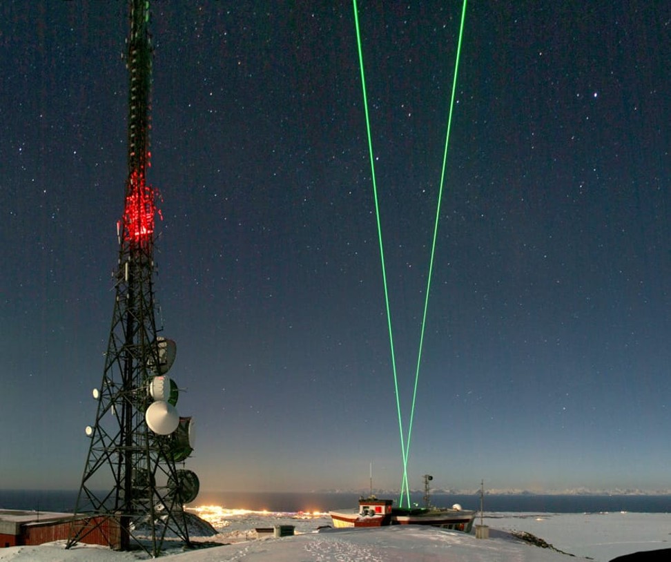
Powerful telescopes will pick up the signals reflected back to earth. Photo: Handout
According to publicly available information, the facility will use several large optical telescopes to pick up the faint signals reflected by the high-altitude atoms when the laser is fired at them.
The project is part of the Meridian Space Weather Monitoring Project, an ambitious programme that started in 2008 to build one of the largest, most advanced observation networks on Earth to monitor and forecast solar activities.
By 2025 Meridian stations containing some of the world’s most powerful radar systems will be established across the world – with facilities in Arctic and Antarctic, South China Sea, the Gobi desert, the Middle East, Central Asia and South America.
China in race for counter-drone tech and laser weapons as it tries to catch up with US
The purpose of the Meridian project, according to the Chinese government, is to reduce the risk abnormal solar activities pose to a wide range of Chinese assets including super-high voltage power grids, wireless communication, satellite constellations, space stations or even a future base on the Moon.
Chinese laser scientists have developed some of the world’s most sophisticated systems in recent years, including ranging stations that can track the movement of satellites and space debris, which the Pentagon has claimed have temporarily blinded some American scientists.
Last year researchers based in Xian, the capital of Shaanxi province, announced that they had developed a “laser AK-47” that could set fire to target from a distance of 800 metres.
The use of such a powerful laser raises concerns that passing objects such as planes, satellites or spacecraft – to say nothing of birds – may be at risk from its beams.
But Professor Qiao Yanli, engineer in chief at the Anhui Institute of Optics and Fine Mechanics, part of the Chinese Academy of Sciences, said there was an “extremely low” risk of this happening.
“The sky is enormous. Getting hit by a tiny beam is almost impossible,” he said.
Some much smaller laser radars, such as those installed in auto-driving test vehicles, have reportedly damaged digital cameras by burning a few pixels on sensor.
But spacecraft such as earth observation satellites, according to Qiao, usually have some protection mechanisms, such as a warning system, to avoid permanent damage caused by an accidental laser hit.
‘Laser AK-47’? Chinese developer answers sceptics with videos of gun being tested
Professor Li Yuqiang, a researcher at the Yunnan Observatories in Kunming, whose team has measured the distance between the Earth and the Moon by shooting lasers at a reflector placed on the lunar surface during the US Apollo 15 mission, said detecting atom-sized targets on the fringes of the atmosphere posed many technical challenges.
“The number of photons [particles of light] reflected by the sparse gas particles will be very small. Even if they can be picked up by large telescopes on the ground, the analysis will require some very good algorithms to separate the useful signals from the noise,” Li said.
“How that can be achieved is beyond the scope of my knowledge.”
Image copyright NRO/USGSImage caption The Hexagon images were declassified in 2011 and digitised for scientific study
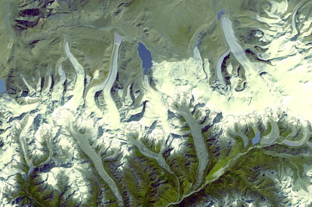
Images from Cold War spy satellites have revealed the dramatic extent of ice loss in the Himalayan glaciers.
Scientists compared photographs taken by a US reconnaissance programme with recent spacecraft observations and found that melting in the region has doubled over the last 40 years.
The study shows that since 2000, glaciers heights have been shrinking by an average of 0.5m per year.
The researchers say that climate change is the main cause.
“From this study, we really see the clearest picture yet of how Himalayan glaciers have changed,” Joshua Maurer, from Columbia University’s Lamont-Doherty Earth Observatory in New York, told BBC News.
Image copyright NROImage caption The Hexagon satellites were a top secret American reconnaissance programme
During the 1970s and 1980s, a US spy programme – codenamed Hexagon – launched 20 satellites into orbit to secretly photograph the Earth.
The covert images were taken on rolls of film that were then dropped by the satellites into the atmosphere to be collected mid-air by passing military planes.
The material was declassified in 2011, and has been digitised by the US Geological Survey for scientists to use.
Among the spy photos are the Himalayas – an area for which historical data is scarce.
By comparing these pictures with more recent satellite data from Nasa and the Japanese space agency (Jaxa), the researchers have been able to see how the region has changed.
The Columbia University team looked at 650 glaciers in the Himalayas spanning 2,000km.
The group found that between 1975 and 2000, an average of 4bn tonnes of ice was being lost each year.
But between 2000 and 2016, the glaciers melted approximately twice as fast – losing about 8bn tonnes of ice each year on average.
Image copyright NASAImage caption We now have a satellite record approaching nearly 50 years in length
Mr Maurer said: “For a sense of scale, 8bn tonnes of ice is enough to fill 3.2 million Olympic-sized swimming pools per year.”
And the ice loss was not uniform, he added.
“Glaciers lose most of their ice in the lower elevation portions of the glacier, and it’s there where most of the thinning is concentrated.
“Some of those zones have been thinning by as much as 5m per year.”
Among the scientific community, there has been some debate over the cause. Changes in rainfall in the region and soot deposited from industrial pollutants are thought to have hastened the melt.
However the Columbia team said that while these factors were contributing, rising temperatures in the Himalayas were the main cause.
“The fact we see such a similar spatial pattern of ice loss across so many glaciers across such a large and climatically complex region suggests there needs to be some kind of overall forcing affecting all of the glaciers similarly.”
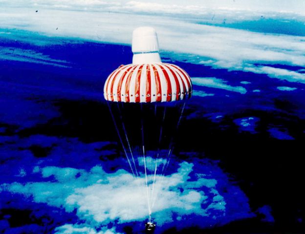
Image copyright NROImage caption The Hexagon photographs would come down in a capsule from the satellites
Scientists say continued losses will have a huge impact.
In the short-term, the huge increase in meltwater could cause flooding.
In the longer term, millions of people in the region who depend on glacier meltwater during drought years could experience very real difficulties.
Commenting on the research, Dr Hamish Pritchard from the British Antarctic Survey, said: “What’s new here is being able to see how the melting of glaciers across the whole Himalayan range has increased due to climate change.
“Over one generation, the melt has doubled and these glaciers are now shrinking fast.
“Why does this matter? Because when the ice runs out, some of Asia’s most important rivers will lose a water supply that keeps them flowing through drought summers, just when water is at its most valuable.
“Without mountain glaciers, droughts will be worse for millions of water-stressed people living downstream.”
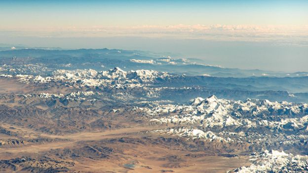
Image copyright NASAImage caption The view of the Himalayas for the International Space station


 BepiColombo